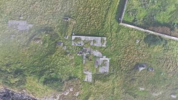
This accommodation camp for the personnel of the Radar Station (NG08SE) is situated to the SW of St Clement's Church (NG08SW 7) on the W side of the A859 road.
There are many hut bases still extant, a water tank and two air-raid shelters were also noted on the date of visit 2002.
The hutted camp is visible on vertical air photographs taken in 1946 (106G/Scot/UK 104, 4180-4182, flown 19 May 1946), in an area immediately N of the walled garden of the Rodel Hotel (NG08SW 11).
At least sixteen mainly Nissen type huts are visible, including a group of four conjoined huts forming a t-shape in plan and what is possibly an electricity generating house at NG 04672 83100. Only one hut base can be seen on the photographs. The hut bases are depicted on the current OS 1:2500 scale digital map 2005.
Master record for the Rodel Park Radar Station Domestic Site. Individual records have further information and photographs. This site is the domestic site for the WWII Rodel Park Radar Station, located 850m to the NW.
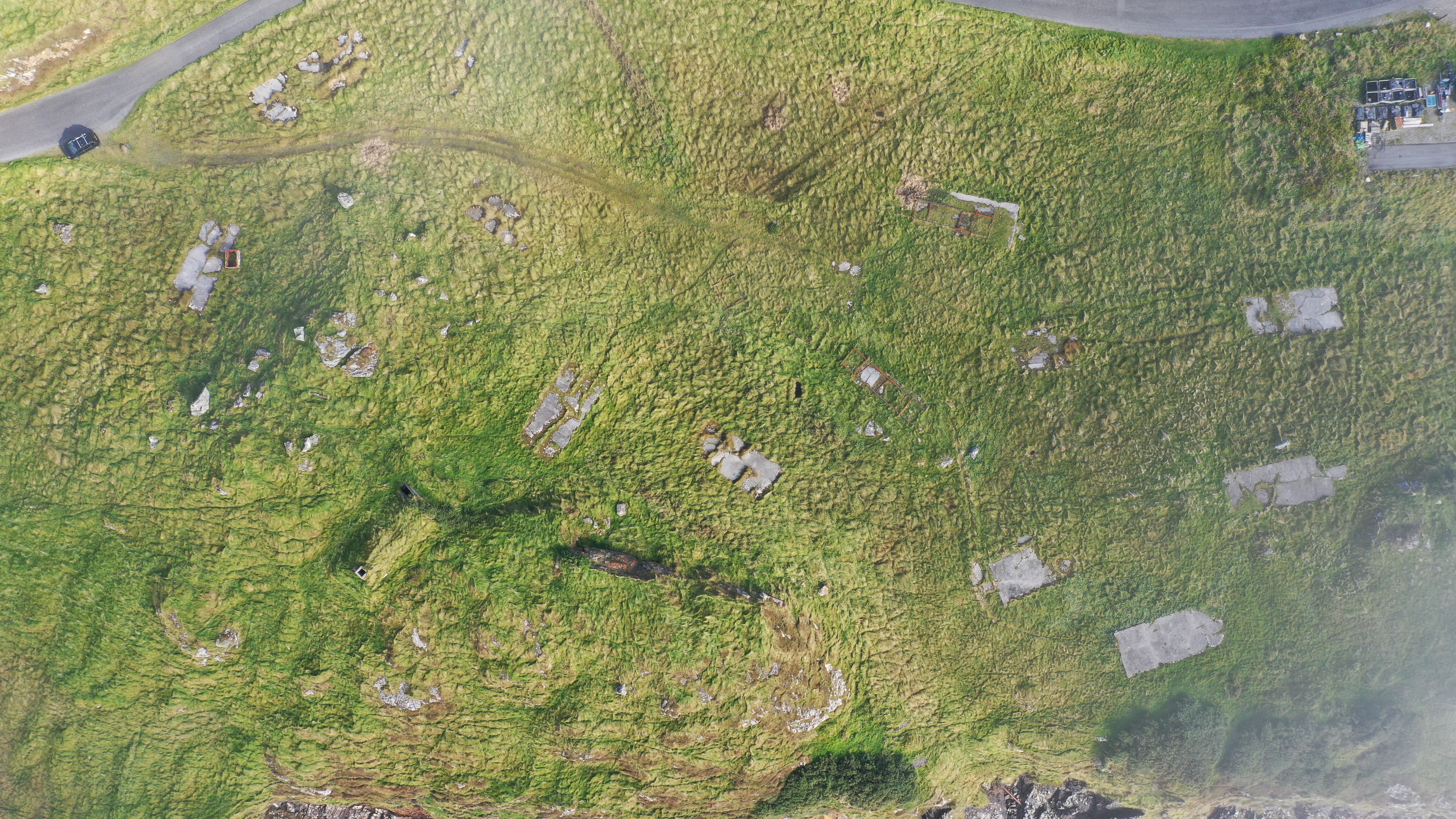
No contemporary plan exists of the site. Aerial imagery from 1966 are part of Canmore's John Dewar collection and shows many of the structures still standing (SC 1528216, SC 1528225, SC 1528226, SC 1528227, SC 1528229). Information from Ian Brown at the National Museum of Flight has tentatively identified many of the structures:
Two air raid shelters (possible Stanton type) (R72, R56).
Combined Dining Room, Sergeants Mess and Officers Mess (R59)
Concrete standing for Nissen huts and probable barrack blocks (R65, R66, R68, R70, R71)
Water tanks (R55, R62, R75)
Mechanical Transport Shed (R54)
And various areas of concrete hard standing (R53, R57, R58, R60, R61, R63, R64, R67, R69, R73, R74).
Location
104667.54
883054.64
27700
57.7397108
-6.9646384
Submitted photographs
Image
Date
Caption
User
22/11/2024
Aerial view of Sick quarters R73 and air raid shelter R72
JulietteMitchell
22/11/2024
Aerial view of the Rodel Park accommodation block. The concrete hard standing for five Nissen huts are visible, as well as the air shaft for the air raid shelter in the bottom right.