Reports
View and download reports. These are organised in publication date order and include the file size.
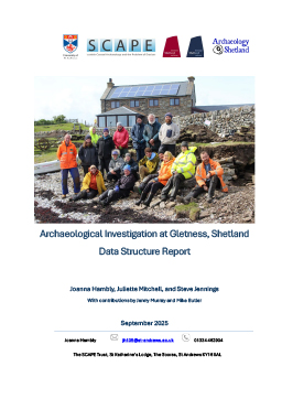
Archaeological Investigation at Gletness, Shetland Data Structure Report
2025. Report of archaeological fieldwork at Gletness, South Nesting, Shetland. 8MB
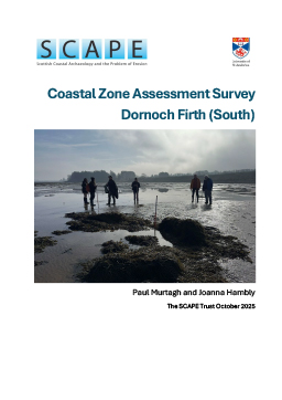
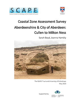
Dornoch Firth (South) Coastal Zone Assessment Survey
2025. Dornoch Firth (South) Coastal Zone Assessment Survey report. 9MB


Stronsay, Orkney: Coastal Zone Assessment Survey report
2024. Stronsay, Orkney Coastal Zone Assessement Survey report. 15MB
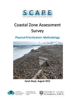
Coastal Zone Assessment Survey Physical Prioritisation: Methodology
2022. Outline of the methodology used to target archaeological survey at coastlines most vulnerable to coastal erosion. 800KB.

Kirkcudbright Bay wreck recording
2020. Survey, recording and historical research of two intertidal wrecks in Kirkcudbright Bay. 12MB

Application of an eroding coastal heritage site dataset to test models of coastal erosion susceptibility, and historic coastal change
2019. A case study from Sanday, Orkney. 1MB

Archaeological investigations at Sna Broch Fetlar, Shetland 2019
2019. Fieldwork report of archaeological investigation and survey at Sna Broch Fetlar, Shetland. 8MB

Archaeological investigations at the Wemyss Caves Fife 2019
2019. Fieldwork report of archaeological investigations at the Wemyss Caves. 9MB

Higgin’s Neuk a search for a royal dockyard
2019. Multi-disciplinary investigation and archaeological excavation of the site of James IV royal dockyard. 18MB
Solway Coastwise survey
2019. Community recording and historical research at three areas of the Solway coast – Redkirk Point, Gretna; Auchencairn, Dalbeattie and Cairnhead Bay, Whithorn. 10MB

Submerged forest, intertidal archaeology and a Bronze Age butchery site, Lionacleit, Benbecula
2019. Article published in Hebridean Naturalist No. 19. 5MB

A review of Scotland’s coastal heritage at risk
2017. Review and recommendations for coastal heritage at risk in Scotland. 3MB

Findhorn fishing boat graveyard
2017. Survey and historical research of a fishing boat graveyard near Findhorn. 8MB
Loch Fleet fishing boat graveyard
2017. Survey and historical research of Embo’s fishing boat graveyard in Loch Fleet. 6MB

Newshot Boat Graveyard Erskine
2017. Survey and historical research of the Newshot Island boat graveyard. 6MB

Scotland’s Coastal Heritage at Risk evaluation
2017. Evaluation report of the Scotland’s Coastal Heritage Project. 5MB

Submerged forest at Sheabie, Berneray, North Uist 2017
2017. Palaeoecological investigation of a submerged forest, Berneray, North Uist. Interim report. 3MB

Brora data structure report 2011
2012. Results of archaeological fieldwork carried out in 2011. 14MB
Baile Sear data structure report 2010
2010. Results of archaeological fieldwork carried out in 2010.10MB


Eroding limekilns, Boddin Point, Angus
2010. History and laser scan survey of 18th century eroding limekilns at Boddin Point. 20MB


Brora data structure report 2009
2009. Results of archaeological fieldwork carried out in 2009. 11MB

Baile Sear data structure report 2008
2008. Results of archaeological fieldwork carried out in 2008. 7MB


Baile Sear data structure report 2007
2007. Results of archaeological fieldwork carried out in 2007. 22MB


Sandwick data structure report 2007
2007. Results of archaeological fieldwork carried out in 2007. 9MB

Baile Sear data structure report 2006
2006. Results of archaeological fieldwork carried out in 2006. 2MB

Brora an archaeological assessment 2006
2006. An archaeological assessment of the extractive industries of Brora by CFA Ltd. 13MB


Loch Hourn survey 2006
2006. Coastal survey and excavation undertaken by the North of Scotland Archaeological Society at Loch Hourn. 9MB
North Uist east coast
2006. Berneray causeway to Srom Ban and Langais to Cachan Bhurabhal (Loch Euphort). 29MB

Sandwick data structure report 2006
2006. Results of archaeological fieldwork carried out in 2006. 6MB
Firth of Clyde: Kintyre and Isle of Arran
2005. East Kintyre (Tarbert to Campbeltown) and South Arran (Drumadoon Point to Clauchlands Point). 24MB


Sandwick data structure report 2005
2005. Results of archaeological fieldwork carried out in 2005. 26MB

South Uist, Benbecula, Grimsay west coast
2005. Entire coast of Grimsay, west coasts of Benbecula and South Uist. 15MB
Brora erosion diary 2004
2004. A report summarising the condition of the Brora salt pans in October and November 2004. 1MB

Brora salt pans history and preliminary survey 2004
2004. The history and preliminary survey of eroding salt pans in Brora, Sutherland undertaken by the Clyne Heritage Society. 1MB

Firth of Clyde and Isle of Bute
2004. Inner Clyde north (Erskine Bridge to Helensburgh), Inner Clyde south (Black and White Cart rivers to Port Glasgow) and the Island of Bute. 34MB

Locating fishtraps on the Moray and the Forth
2004. A study aimed explaining the huge difference between the number of fishtraps in the Moray and the Forth. Is it due to varying fishing practices, changes in the coastline or a reflection of the archaeological surveys themselves? 15MB
Loch Hourn survey 2004
2004. Coastal survey of Inner Loch Hourn undertaken by the North of Scotland Archaeological Society. 22MB

Sandwick data structure report 2004
2004. A report of the first seasons archaeological assesssment. 4MB
Airborne remote sensing and GPR survey, Coll and Tiree

Firth of Clyde
2003. Island of Great Cumbrae, south and east Cowal Peninsula (Ardyne Point to Strone Point) and the Ayrshire coast (Largs to Maidens). 15MB

Loch Hourn survey 2002
2002. A report on the first season of coastal survey undertaken by the North of Scotland Archaeological Society of Loch Hourn. 8MB


Fife volumes 1 & 2
1996/1997. Volume 1: Fife Ness to Newburgh and Volume 2: Kincardine to Fife Ness. Field survey. 23MB