Innermessan, Cairnryan Military Railway (15815)
Condition
| 2 | |
| NISSEN HUT(S) (20TH CENTURY), SLIPWAY (20TH CENTURY), WORKSHOP(S) (20TH CENTURY) | |
| First World War, Second World War | |
| 90259 | |
| MDG10136 | |
| Dumfries and Galloway |
Description
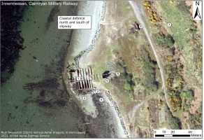
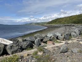
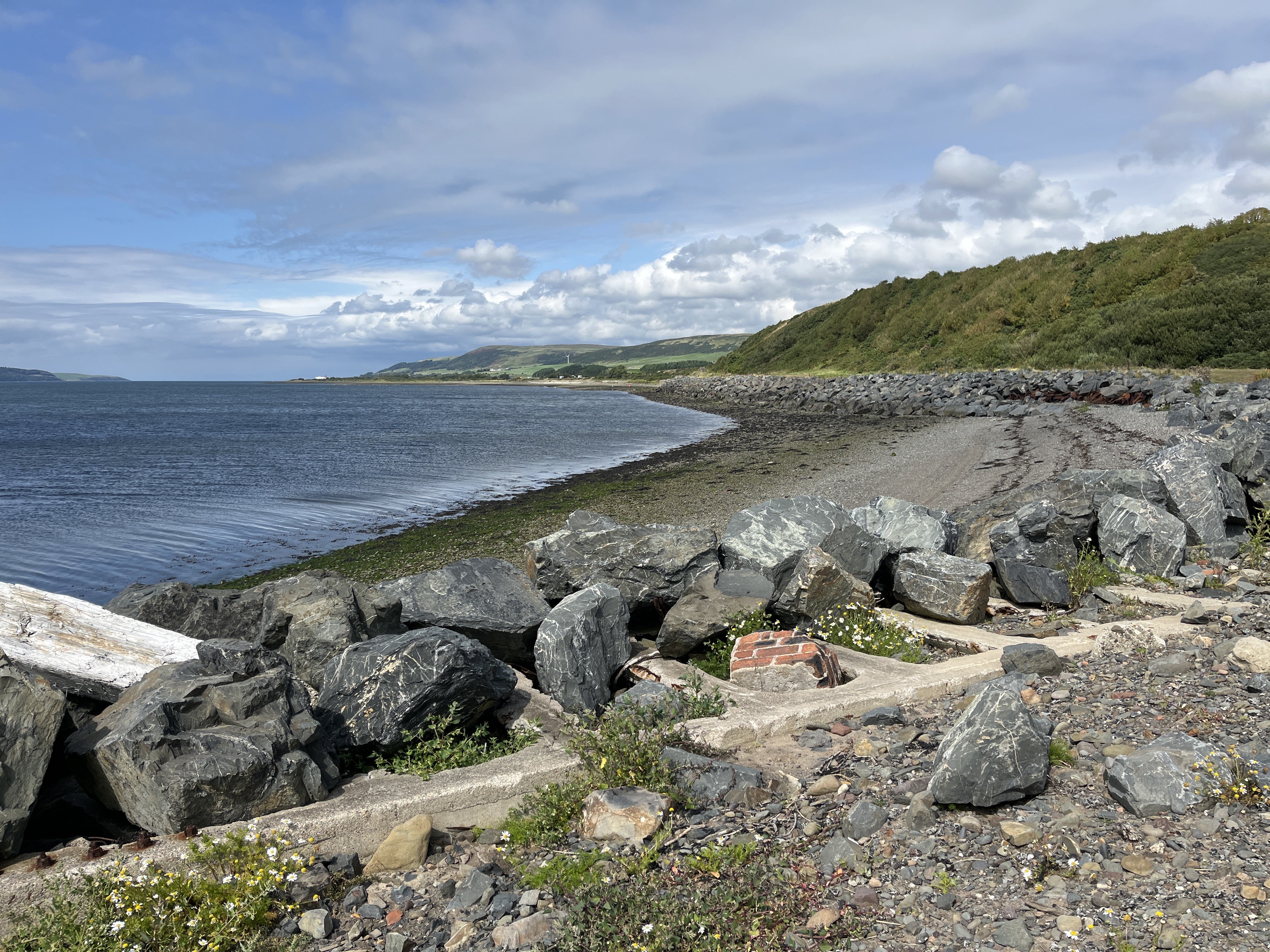
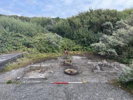
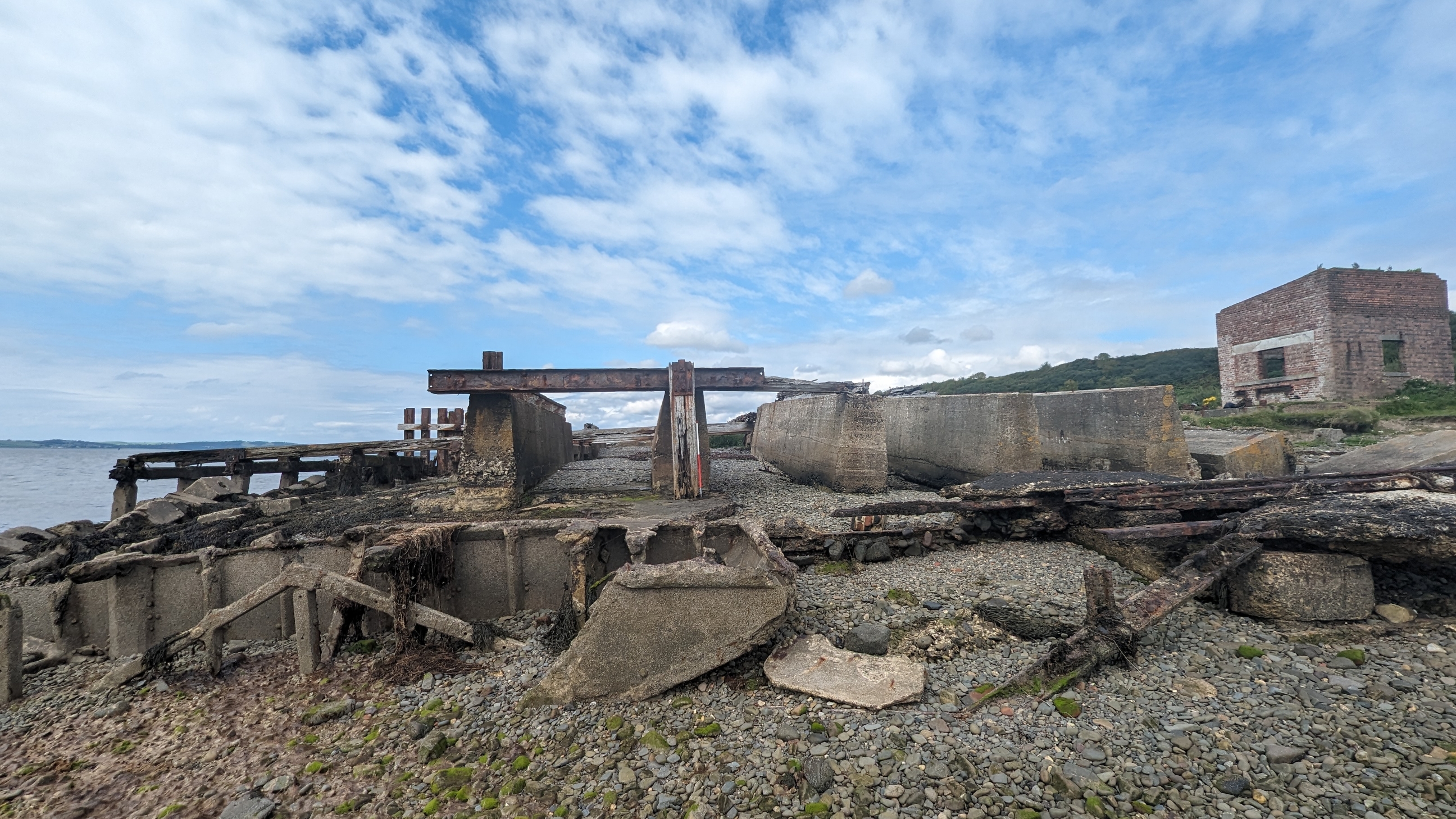
| A ship construction yard. The site was constructed in 1917 to build concrete ships to replace merchant navy shipping being sunk by the unrestricted U-boat war. In the second world war Innermessan camp serviced the tugs and lighters working on what was to become the South Deep Water Wharf. It would eventually be staffed by RAOC and REME personnel. A slipway had survived from WWI and a new one was added and the jetty renewed. A few sidings were built alongside the railway. Concrete bases, slipway, a winch house and other extant remains were noted in 1998. The condition was recorded as 'poor'. The site notes refer to concrete pontoon sections lying on the site and a Pioneer Corps Badge set in sea shells in the concrete railway embankment. |
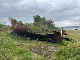
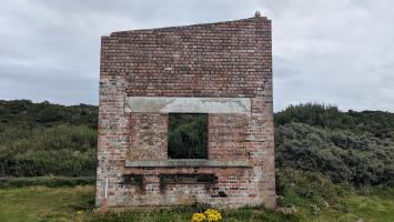
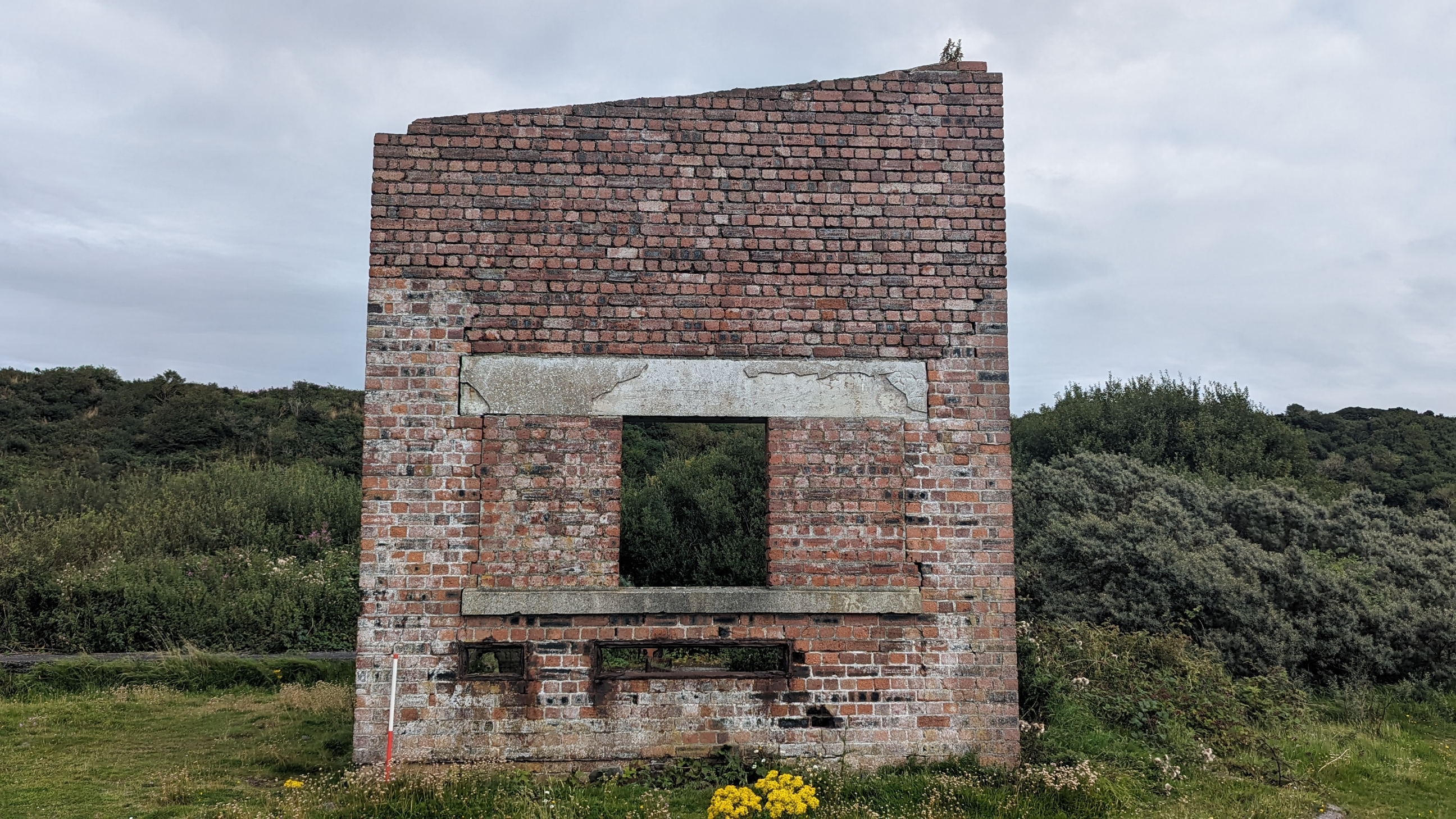
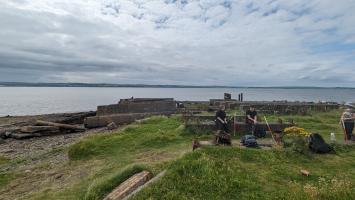
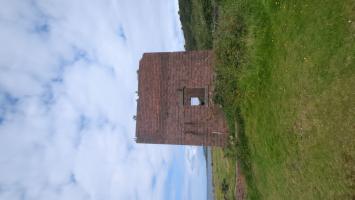
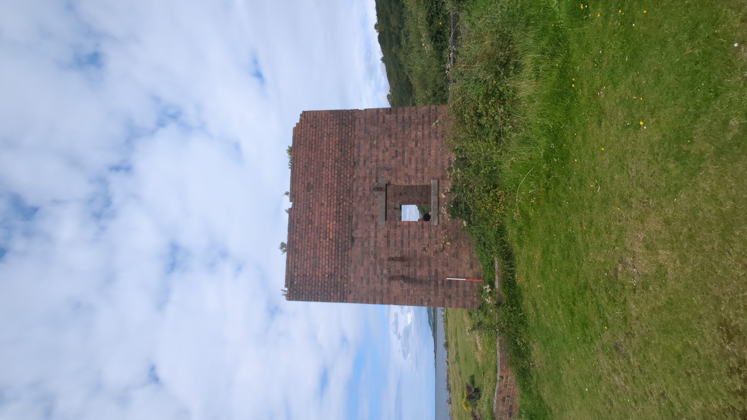
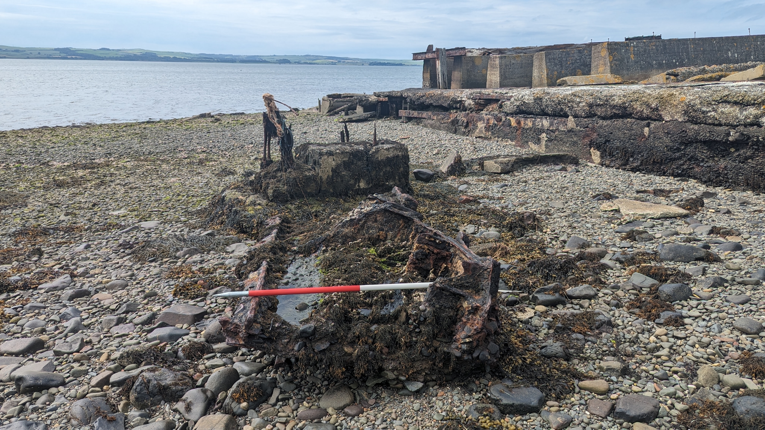
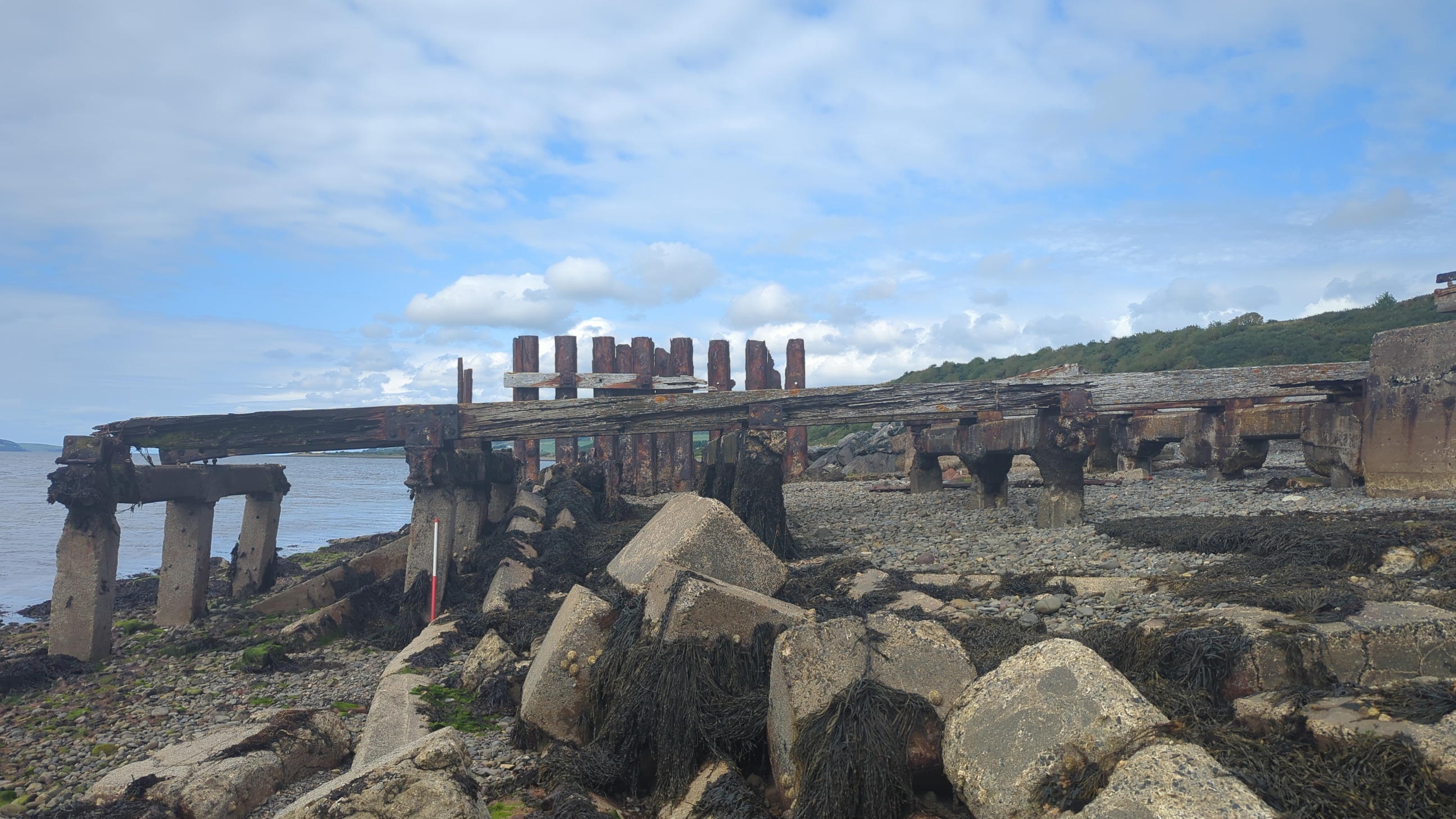
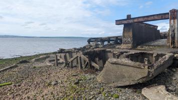
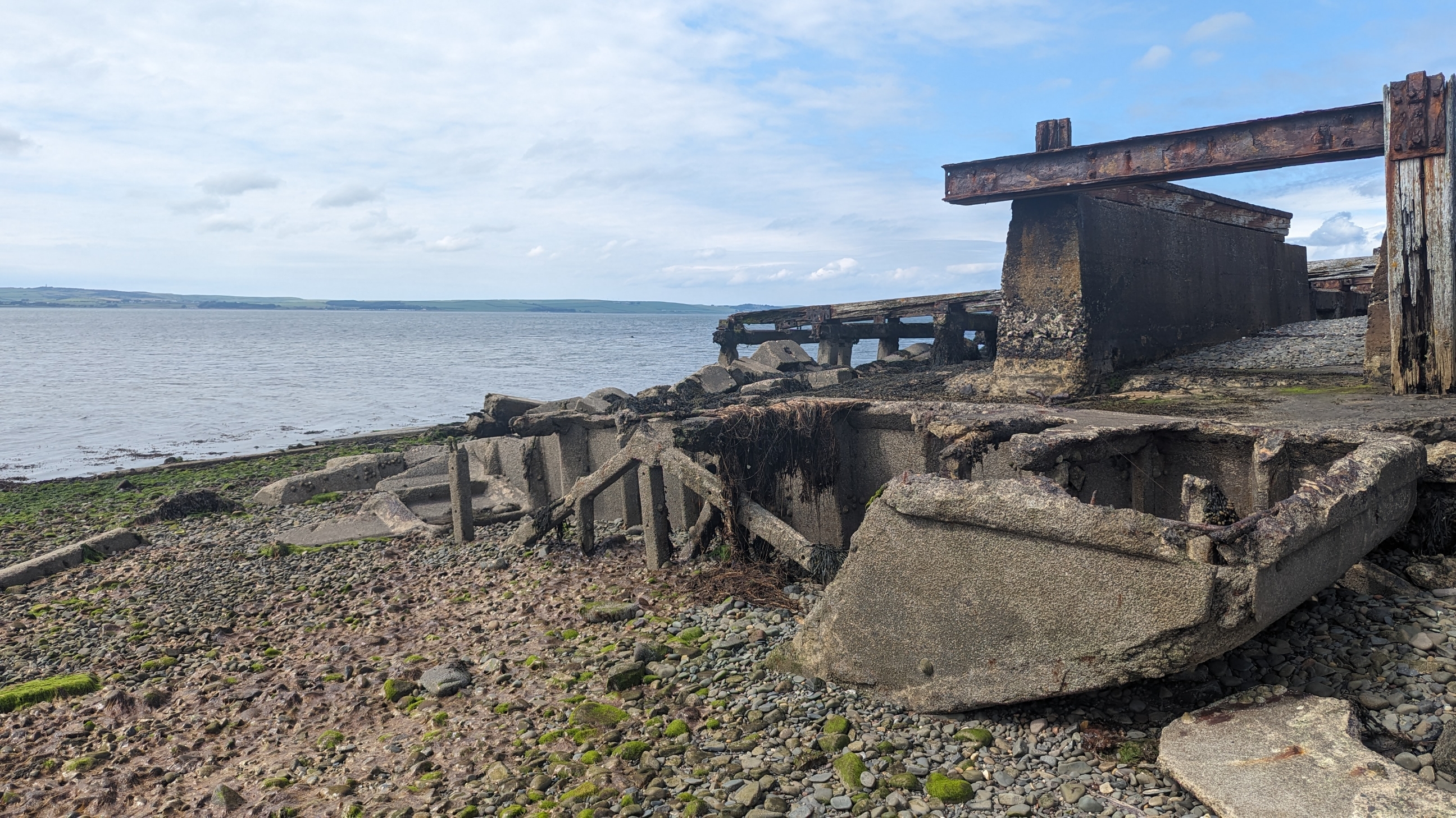
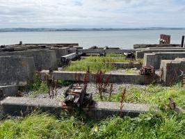
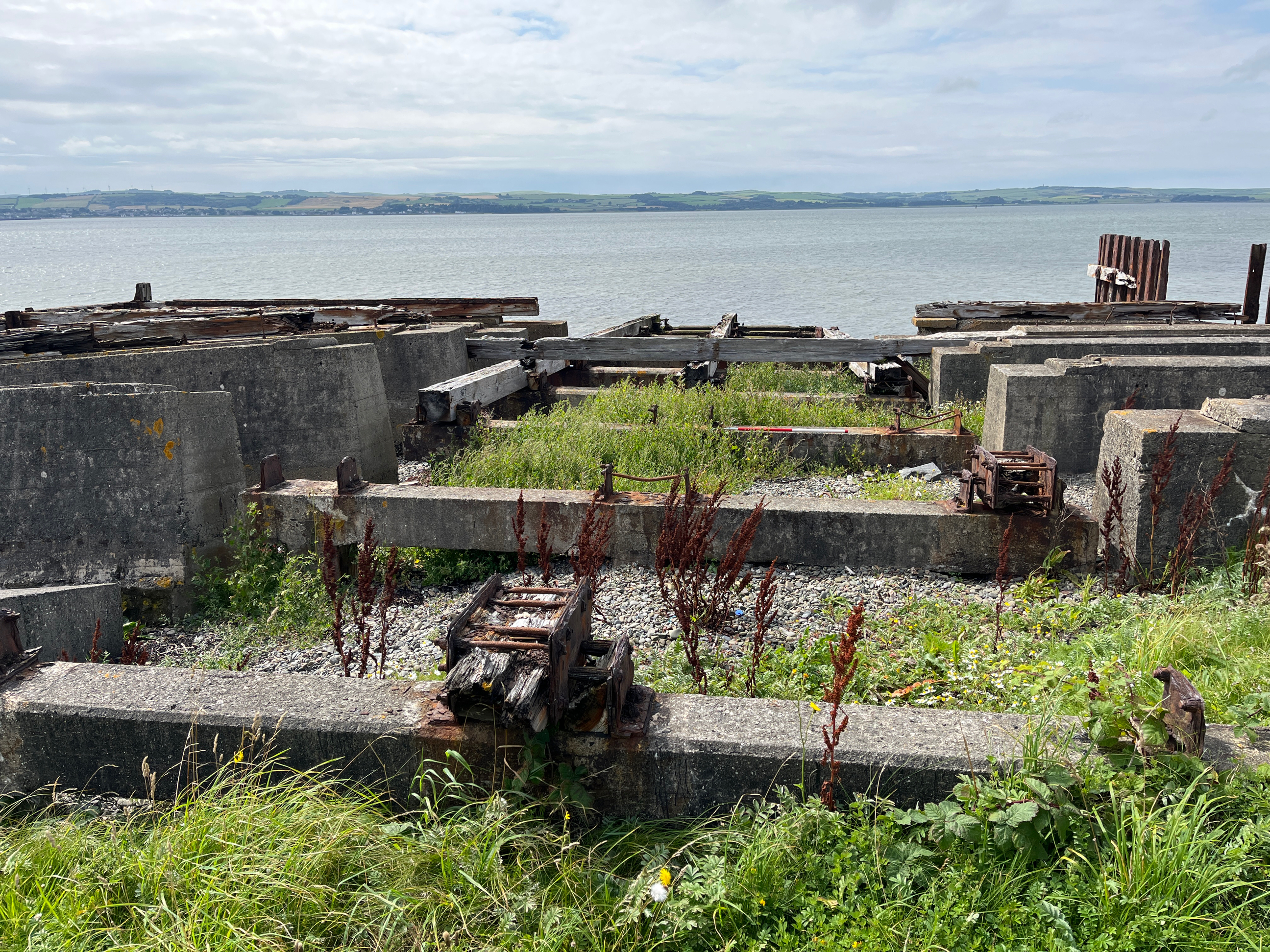
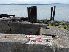
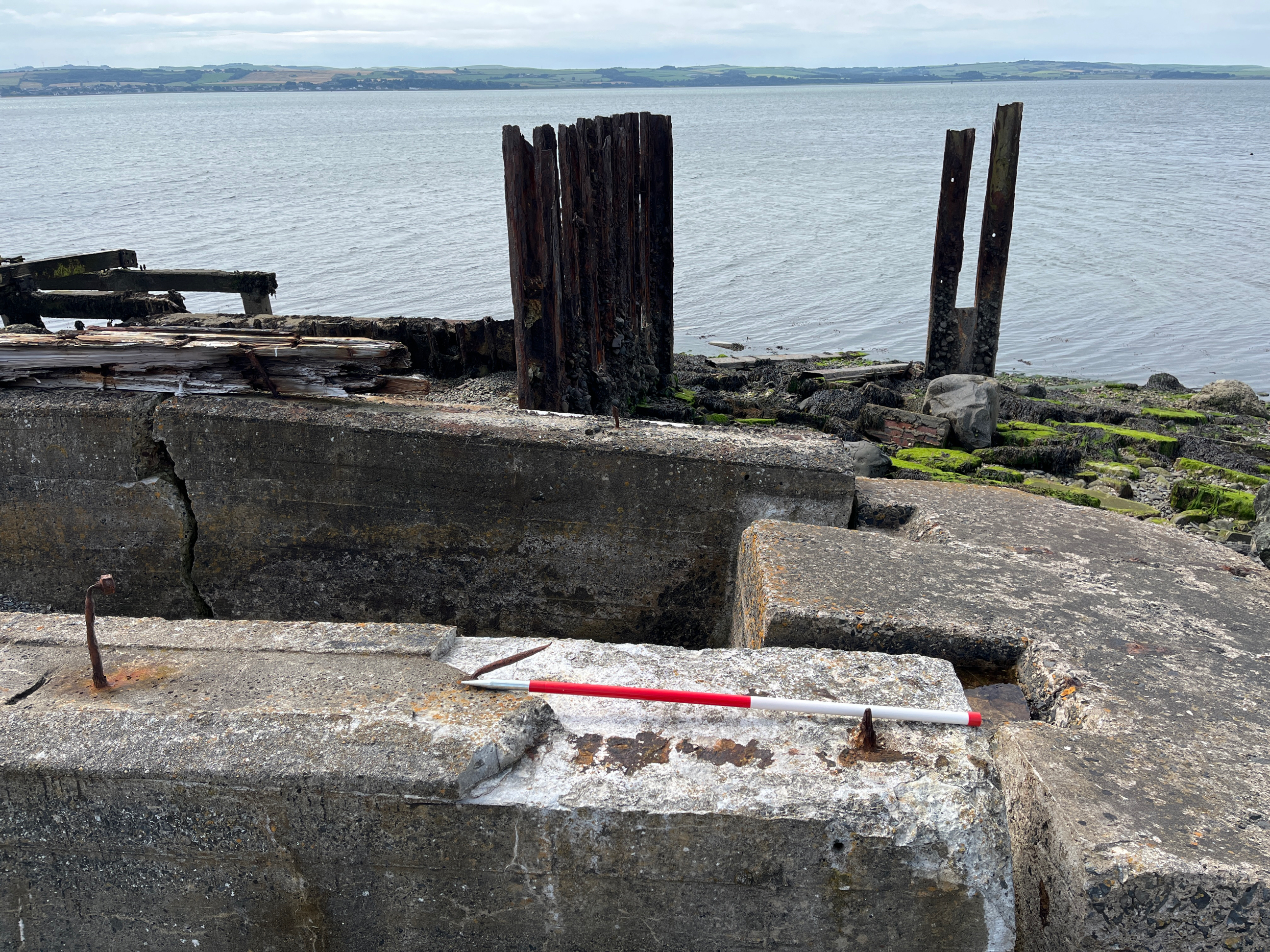
| Concrete, iron and wooden remains of WW1 and WW2 ship building yard and slipway with an unroofed red brick winch house at the landward end of the slipway. Immediately behind the winch house are concrete platforms, most likely the foundation of workshop buildings. To the east of the present day coastal path are further concrete foundations which can be clearly noted on modern aerial, which were the foundations for Nissan huts. The remains of a concrete boat-shaped pontoon is situated immediately to the south of the main slipway. These concrete pontoons, known as 'Beetles' were built to support floating roadways to be used at the D-Day landings. Fabrication of Mulberry Harbour pontoons, including four large 'Whale' beetles occurred at Cairnryan Harbour (Stranraer in World War Two, Archie Bell, 2005), and the remains of four Mulberry beetles were located at Old House Point, Cairnryan (Canmore ID: 323688) before being removed during development of Loch Ryan Port. The dimensions of the concrete boat at Innermessan is smaller than other examples of beetles (see SCAPE ID: 13904; Canmore ID: 287700 for an example of a Mulberry Harbour Beetle, tested at Cairnhead Bay). In addition to the concrete boat, the remains of an object on the south side of the site is filled with cork and bituman and is perhaps the remains of a float. During the August 2023 survey the Pioneer Corps Badge set in sea shells was not found. Approximately 40m inland of the site is the remains of an iron vessel, however this is not thought to be related to the WWII site and is not observed in photography of the site from that period. The site either side of the main slipway is defended by rock armour, however the concrete, iron and wooden remains of the slipway itself are not defended and are at risk of further deterioration due to wave action. Arial photography taken in 2003 (NCAP, Scottish Beach Survey 2003, Sortie: EAC007, Frame: 6445), and photography from 2009, show nine reinforced concrete rectangular box shaped structures, likely to be concrete pontoon sections which were previously described as lying on the site, however these were not in situ at the time of the 2023 survey. In 2003/09 it was also noted that the rock armour north of the site did not extend the entire way to the slipway like it does as observed during the 2023 survey. Two of these concrete structures are now located approximately 480m north of the site at the northern end of the rock armour (SCAPE ID: 16268) and one can be seen incorporated into the post-2009 rock armour, to the north of the slipways. It is thought that these structures were also related to the Mulberry Harbour construction which took place at the Pile Construction Yard at Old House Point and have been subsequently towed to, and stored, at Innermessan, as suggested by B. Gill in 'The Cairnryan Military Railway' (Gill, 1999). These have then, more recently, been repurposed into the coastal defences in the area. |
Location
| 208300.00 | |
| 563720.00 | |
| 27700 | |
| 54.9312310 | |
| -4.9935750 |
Submitted photographs
| Image | Date | Caption | User |
|---|---|---|---|

|
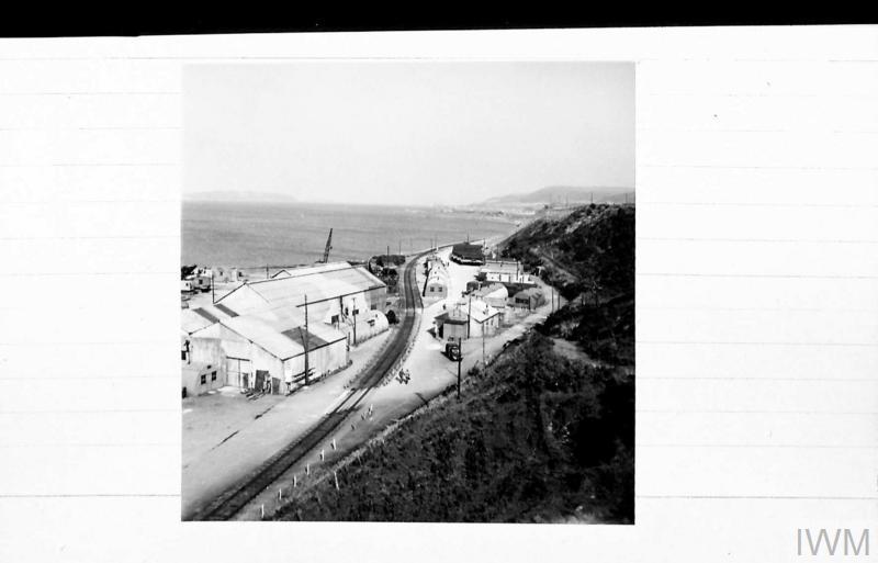
11/12/2023 | Innermessan looking West from cliff top. Courtesy of Imperial War Museum. Photographer: Sergeant Palmer. 1944-09-16 © IWM H 40124 | slboyd |
|
|||

|
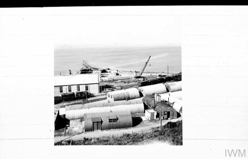
11/12/2023 | Innermessan looking North-West from cliff. Courtesy of Imperial War Museum. Photographer: Sergeant Palmer. 1944-09-16 © IWM H 40123 | slboyd |
|
|||

|
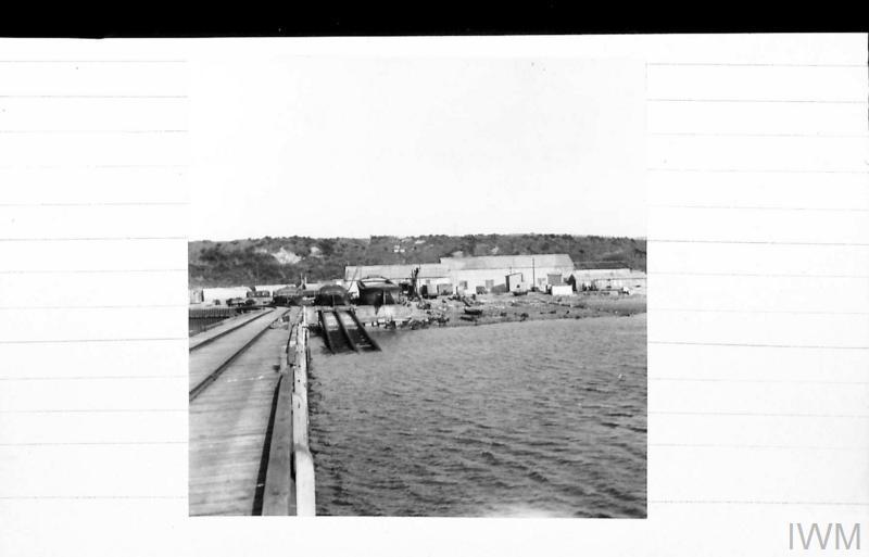
11/12/2023 | Innermessan slipway and workshops from jetty. Courtesy of Imperial War Museum. Photographer: Sergeant Palmer. 1944-09-16 © IWM H 40156 | slboyd |
|
|||
|
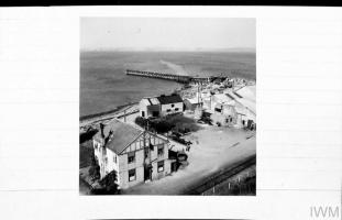
11/12/2023 | Innermessan looking North-West from cliff. Courtesy of Imperial War Museum. Photographer: Sergeant Palmer 1944-09-16 © IWM H 40122 | slboyd |

|
|||
|
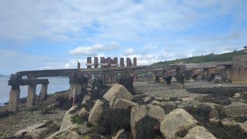
25/09/2023 | Aerial view of Innermessan ship construction yard. | slboyd |
|
|||
|
15/08/2023 | Remains of iron vessel, 40m from coast edge. Location 8 on site map. | slboyd |
|
|||
|
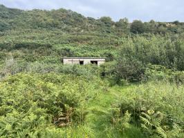
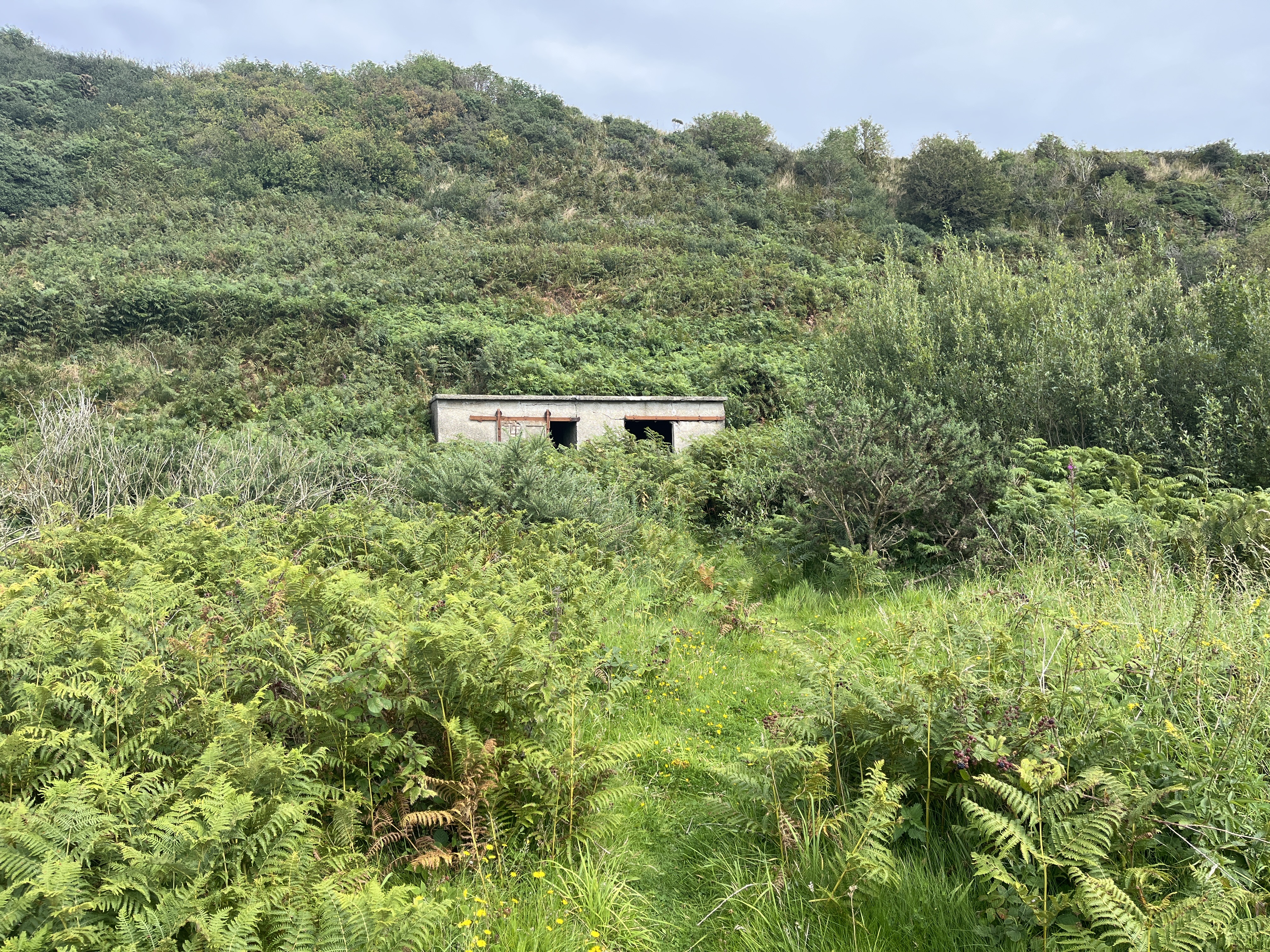
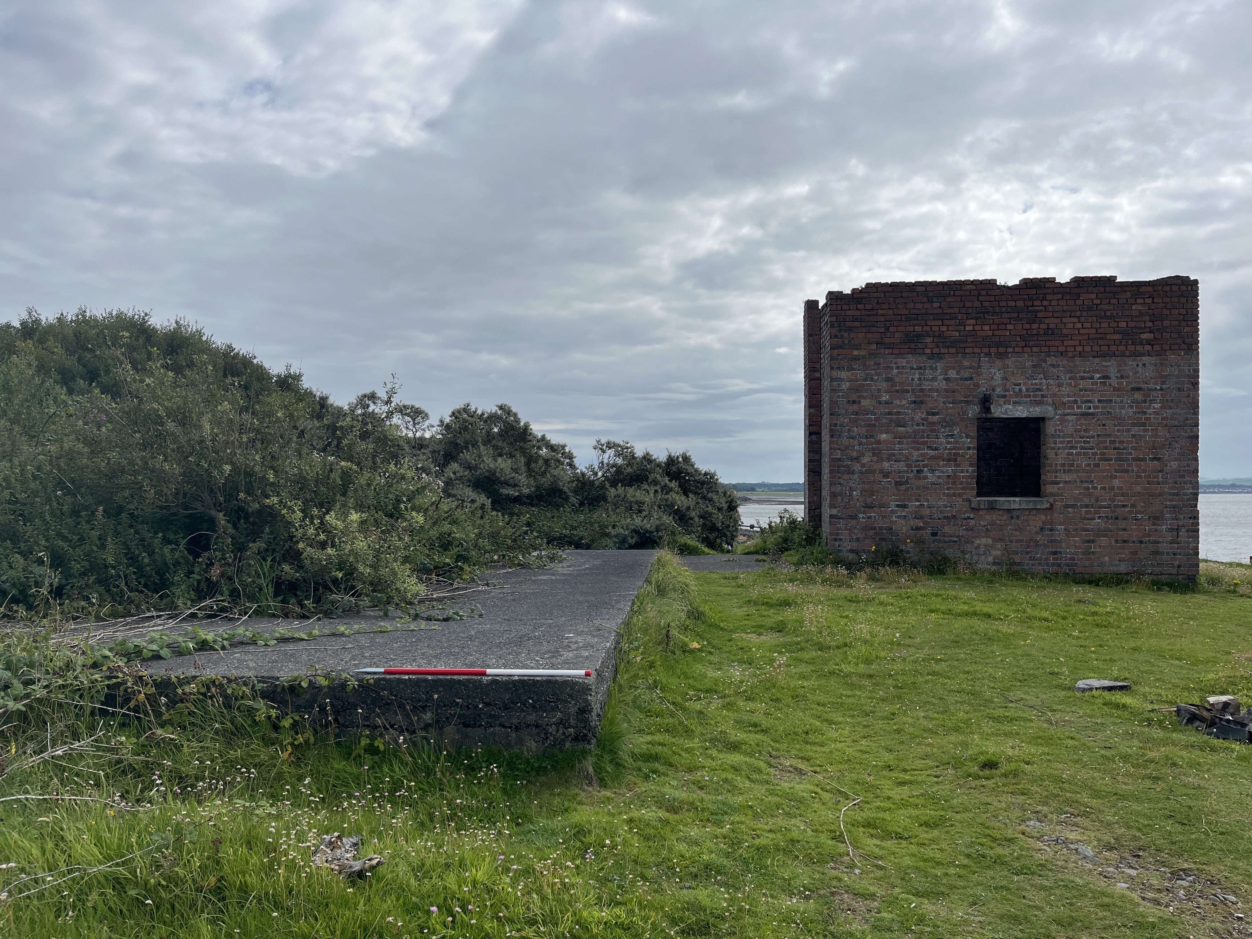
15/08/2023 | Concrete shed, set against vegetated raised shoreline, approximately 70m from coast edge. Location 7 on site map. | slboyd |
|
|||
|
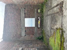
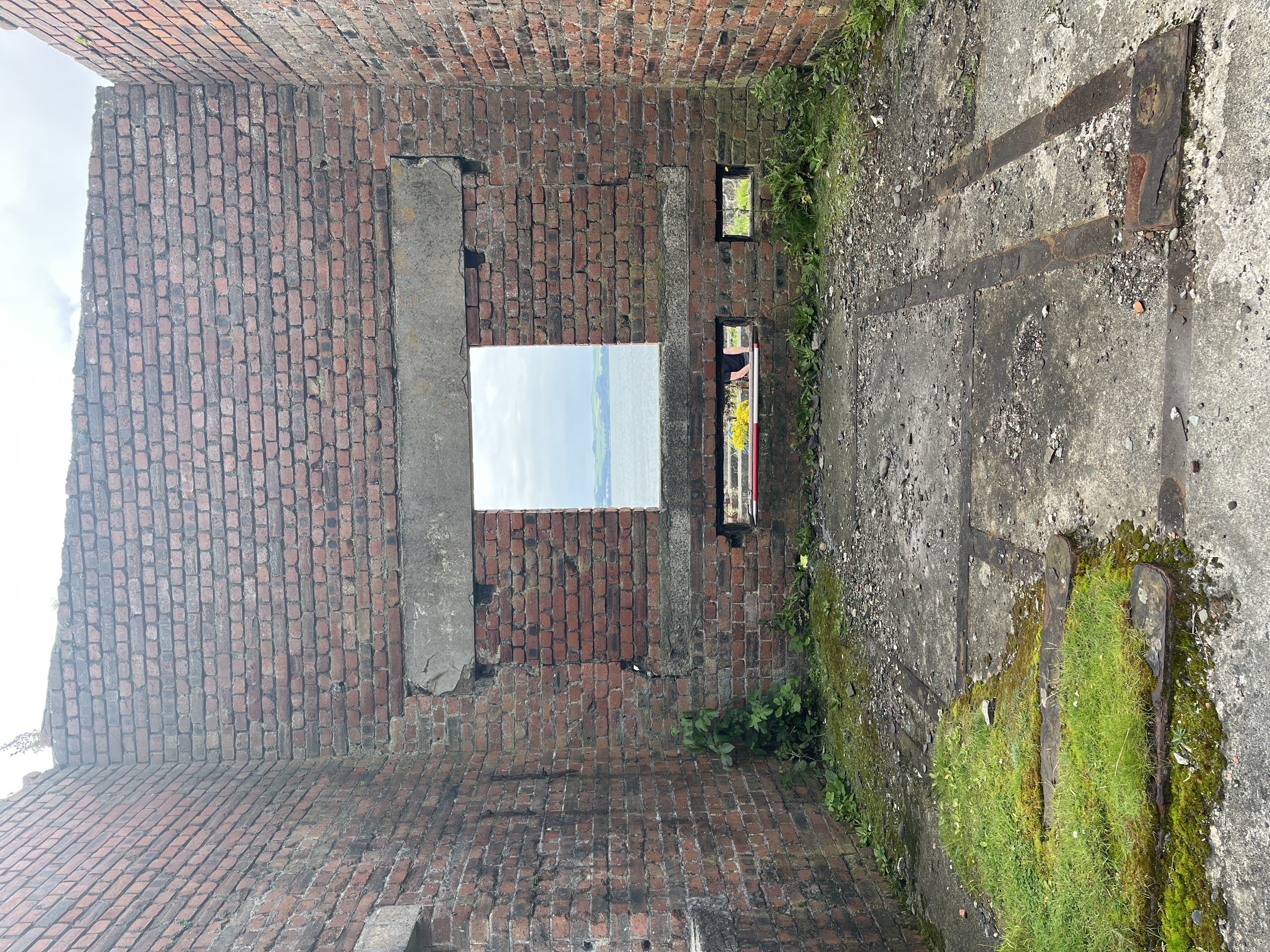
15/08/2023 | Interior of winch house, looking west. Location 5 on site map. | slboyd |
|
|||
|
15/08/2023 | General view of coastline, looking north. Reinforced concrete structure used within rock armour defence. | slboyd |
|
|||
|
15/08/2023 | Concrete base immediately behind winch house, looking east. Location 6 on site map. | slboyd |
|
|||

|
15/08/2023 | Concrete platforms and winch house, looking south | slboyd |
|
|||
|
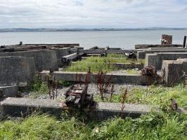
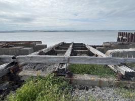
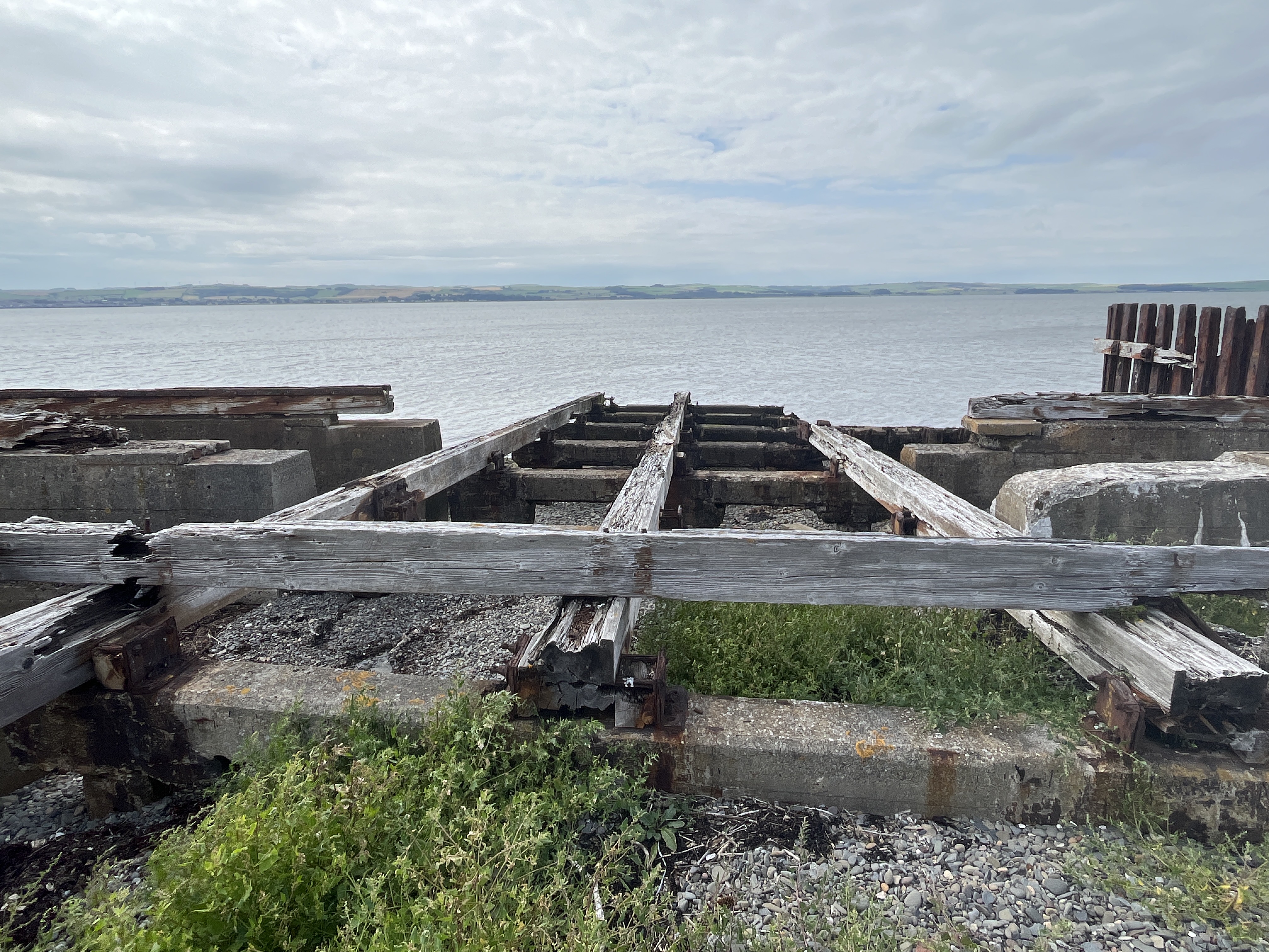
15/08/2023 | Timber and concrete slipway with remains of cast iron fixings, looking west. Location 1 on site map. | slboyd |

|
|||
|
15/08/2023 | Slipway, looking west. Location 1 on site map. | slboyd |
|
|||
|
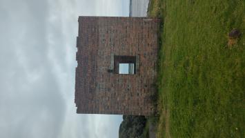
11/08/2023 | Winch house, looking south. Location 5 on site map. | Frankie |

|
|||
|
11/08/2023 | Front view of the winch house, looking East. Location 5 on site map. | Frankie |
|
|||
|
11/08/2023 | General view looking West | Frankie |
|
|||
|
11/08/2023 | Winch house, looking north. Location 5 on site map. | Frankie |
|
|||

|
11/08/2023 | Unidentified object on the Southside of the rail slipway. Location 4 on site map. | Frankie |
|
|||
|
11/08/2023 | Timber and concrete slipway, looking North | Frankie |
|
|||
|
11/08/2023 | Looking North | Frankie |
|
|||

|
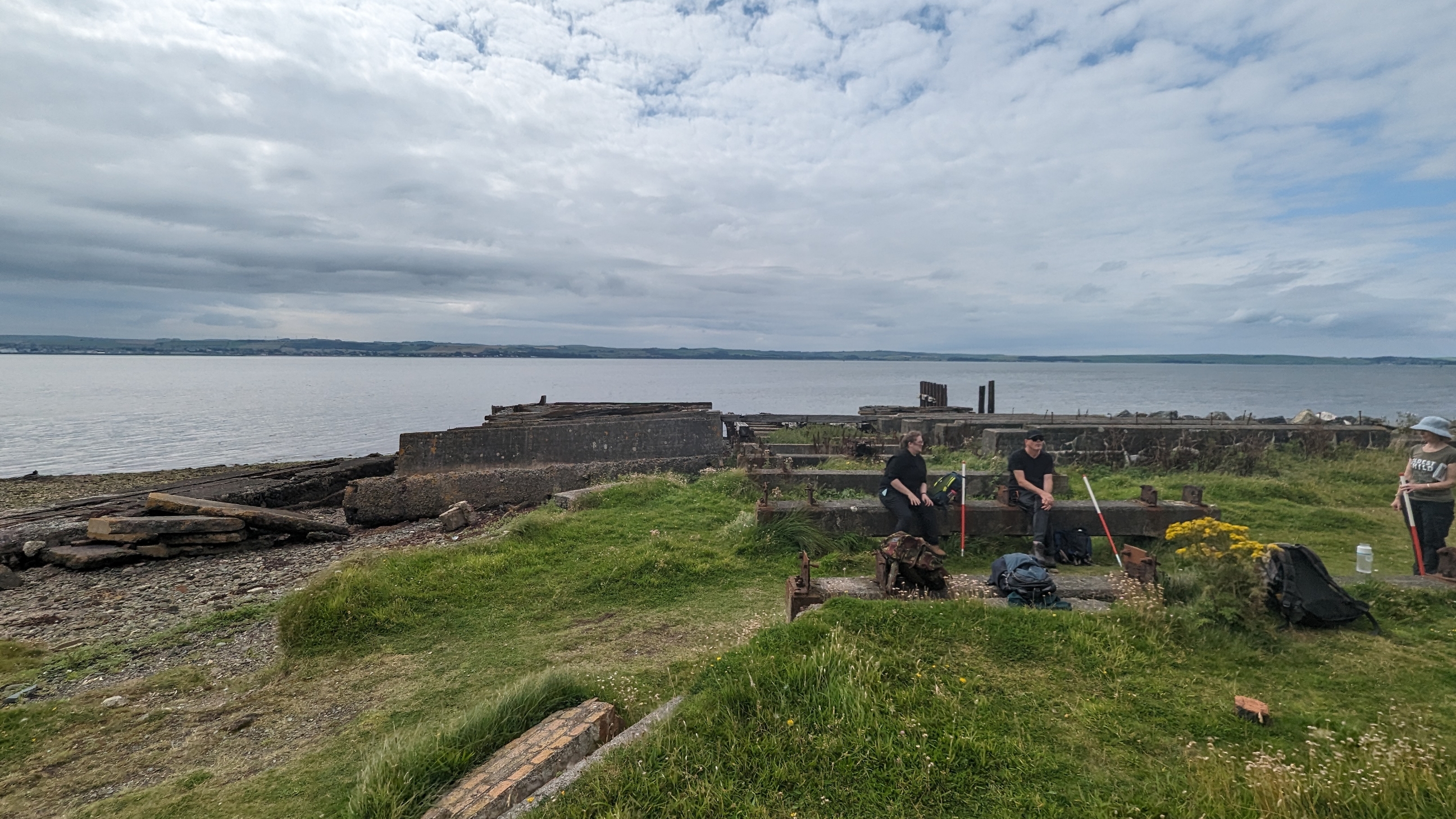
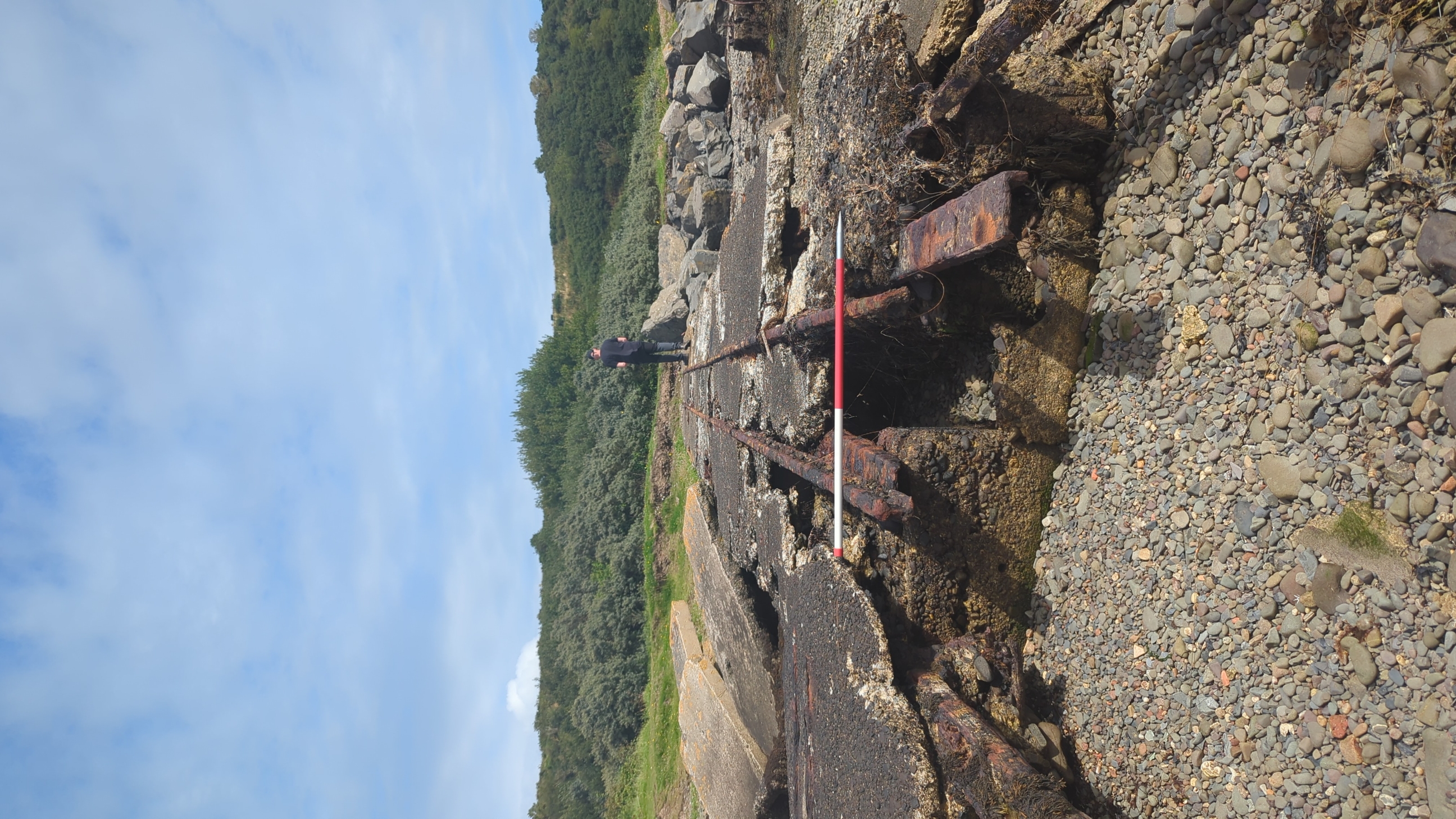
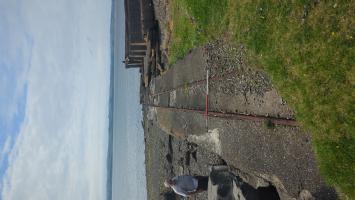
11/08/2023 | Rail slipway looking East. Location 2 on site map. | Frankie |
|
|||
|
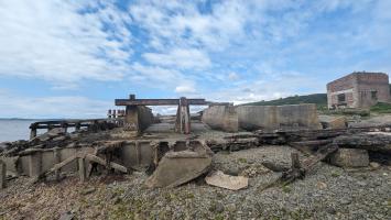
11/08/2023 | Remains of concrete boat to the south of the main slipway. Location 3 on site map. | Frankie |
|
|||
|
11/08/2023 | Rail slipway looking West. Location 2 on site map. | Frankie |

|
|||
|
10/08/2023 | Concrete remains of slipway with corroded iron fixings. Some wooden sections still visible within cast iron. | slboyd |
|
|||
|
10/08/2023 | Concrete and iron remains of slipway and construction yard | slboyd |
|
|||
Submitted updates
| Update id | Date | User | ||||||||||||||||||
|---|---|---|---|---|---|---|---|---|---|---|---|---|---|---|---|---|---|---|---|---|
| 4524 | 11/08/2023 | Frankie | ||||||||||||||||||
|
||||||||||||||||||||
| 4521 | 10/08/2023 | slboyd | ||||||||||||||||||
|
||||||||||||||||||||