Exactly a year to the day from our first visit to Orkney, we are happily back on Sanday preparing for the excavation and relocation of Meur burnt mound in July. The 3000 year old structure is being moved from its current perilous location in the intertidal zone to the new Sanday Heritage Centre where it will be reconstructed and interpreted for visitors.

Burnt mounds are one of the most enigmatic, problematic and exciting archaeological remains of the Bronze Age. Essentially, a tank filled with fresh water is heated with hot stones. When the stones had cooled they were taken out and thrown away nearby. Over time, the structure becomes buried under a pile of fire-cracked stones, hence the name, burnt mound. The Meur burnt mound is a particularly fine example with a stone-built water tank, a corbelled cistern and a number of chambers.

The stone tank and remains of other structures of the Meur burnt mound. You can see how close to the sea it is.
Theories abound as to their function – but the truth is we don’t really know what they were used for. Hot water and steam has many uses. Suggestions include prehistoric bath houses, brewing, food preparation, or boat making. As yet, there is no convincing archaeological evidence to narrow it down.
The community excavation and reconstruction of the Meur burnt mound will give us all a chance to think further about these sites and test theories through archaeological science. Everyone is especially looking forward to learning dry stone building techniques under the expert guidance of Jim Keddie, our specialist mason who will be supervising the reconstruction at the Heritage Centre. Don’t be surprised if Sanday gardens are soon being embellished with mini broch Wendy houses and corbelled barbeques.
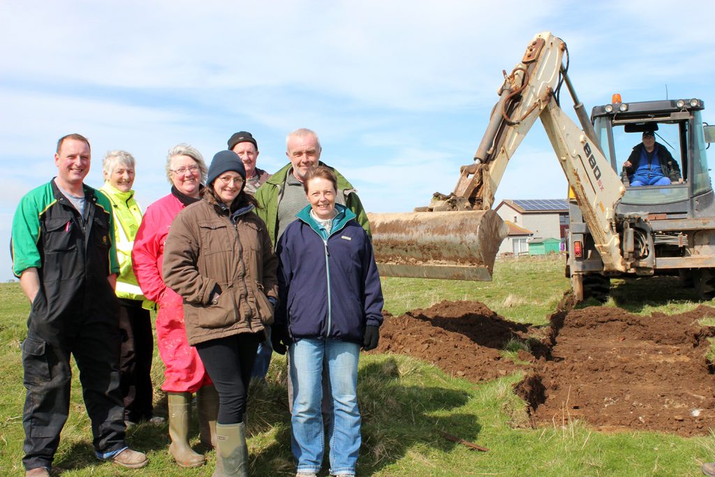
The first cut. Members of the Sanday Development Trust and the Community Council oversee the evaluation of the proposed site of the re-located Meur burnt mound.
It’s not possible to walk along a beach on Sanday without encountering site after site of world class archaeology eroding out of the coast edge. If you can’t spot these immediately – just look for fulmars. In the nesting season fulmars always seem to select a handy bit of eroding masonry to lay their eggs and raise their chicks. In spring and early summer, it’s a fail-safe method of identifying archaeological features.

Fulmars nest amongst neolithic buildings at Stove.
On this visit, we had the good fortune to have Eddie Martin with us. Eddie is a photographer who specialises in low level aerial photography of archaeological sites using a hexacoptor and a pole cam. A speciality of Sanday’s archaeology is settlement mound sites. These are effectively ‘tells’ – mounds of archaeological material created by thousands of years of human occupation of the same place.
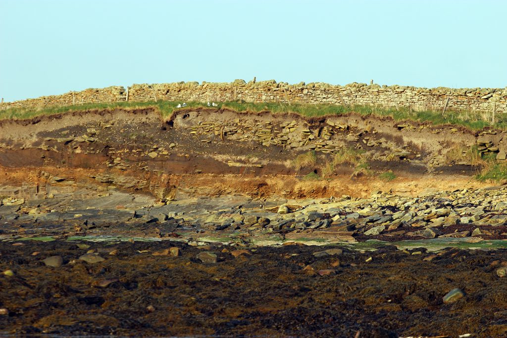
Here at Pool, everything you see above the pale orange layer at the base is archaeology. Excavations have found evidence of habitation from the Neolithic to the medieval period. Note the fulmars!
Many of these are eroding and they are very difficult to record because of the height of the eroding section, which is usually also very unstable, as well as the sheer size of the whole site.

Settlement mound at Northskaill. There is a stone structure to the left of Jo (wearing the white hat). The dark layers are made of hearth ash and organic material. When you get up close it is full of fish bone and burnt stone. The white lines are cockle shells – remains of meals from we don’t know when.
We experimented with a photographic technique known as structure from motion where you take lots of photographs and stitch them together to make a 3D model of your subject. We hope to develop this technique to record difficult and inaccessible coastal sites so that we can properly examine and monitor them.

Screenshot of Eddie’s first draft of the 3D model of the settlement mound at Newark.

Overhead view of a digital terrain model of Newark settlement mound created using low level aerial photography.
As always, we had such a good time in Orkney, all down to the many people who spent time with us and contributed their knowledge, enthusiasm and support in recording Sanday’s incredible archaeology.

We are looking closely at possible evidence of metal working in an undated building eroding out of the coast edge at the Ebb of Seater.

A burial cairn at North Mire. This could be Neolithic or Bronze Age. Like most of Sanday’s eroding sites, no work has been done so we just don’t know.
Best of all this year, we get to spend most of July in Sanday, and will keep you posted on the progress of Meur Burnt Mound.
Recent Comments