Nov 18, 2025
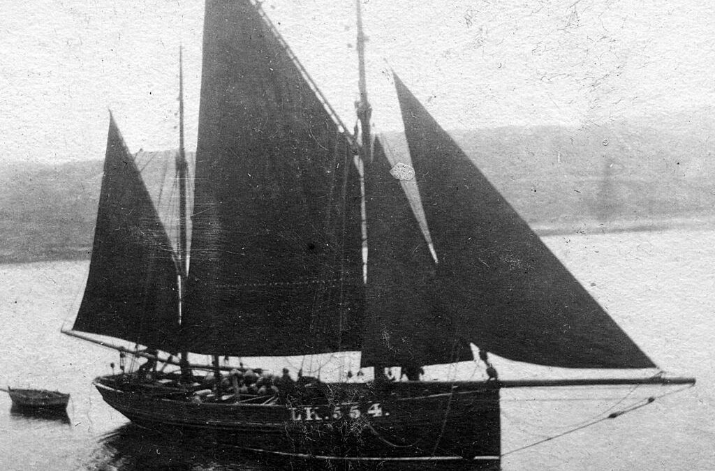
In a quiet inlet of Southladie Voe, West Sandwick, Yell (Shetland), lies the remains of an old wooden wreck. Enough survives to identify her as a probable Class 1 sailing drifter, though her design differs from the more familiar Zulus and Fifies of the Scottish...
Sep 5, 2025
The stunning beach at Sands of Breckon is a magnet in North Yell for locals and visitors alike – but did you know that by taking a short walk around the headland you will discover a rich archaeological landscape of settlement, burials and historic structures. Our...

May 6, 2025
Just east of John O’ Groats at a place called Robert’s Haven, you can see fragments of drystone walls and dark coloured soils full of pottery, shell, and fish bone eroding out of the dunes. Thanks to an archaeological investigation by James Barrett in the early 1990s,...

Dec 5, 2024
Going through the records after a survey is always a pleasure and is often when the true significance of a place is revealed. Borosdale Bay near Rodel on the Isle of Harris is a great example. The falling tide uncovered an array of stone structures across the...

Nov 11, 2024
During WW II Scotland’s coast was defended from attacks from the air and sea. Pill boxes, lines of concrete tank cubes and anti-glider posts were part of the coastal crust to prevent beach landings of planes and vessels with tanks. The famous Churchill Barriers...

Aug 23, 2024
St Andrews is once again hosting the AIG Women’s Open Golf Championship this year and we thought we would take this opportunity to highlight the archaeology of the Old Course, the history of the women’s game in Scotland, and its links with the coast. St Andrew’s is...
Recent Comments